
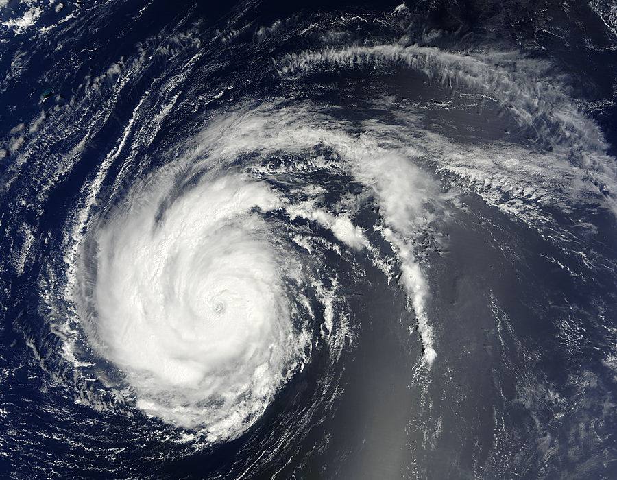
This is the first big hurricane of the Atlantic tropical storm season. Danielle was a category 4 hurricane making a classic run across the Atlantic. It went through an eyewall replacement which has weakened it to a category 2 cyclone. (Click on any image to enlarge)

Intensity forecasts suggest this cyclone will probably not intensify, however it will likely become a very powerful extra-tropical cyclone wreaking havoc on the Atlantic shipping lanes. At present Danielle poses no immediate threat to populated areas and is forecast to pass east of Bermuda. This could give Bermuda tropical storm force winds. Cape Race, Newfoundland will be one of the closest points of approach of this storm although, if the upper level troughs which are steering it continue to provide influence there is little likelihood that the Maritime provinces will feel much effect. The problem is that as Danielle approaches 50 degrees North, it will have a lot of energy left in it.
 Tropical Storm Earl may be a different story. This cyclone is tracking west at about 16 knots (30 kmh/18 mph) influenced by a subtropical ridge. The forecast models all suggest that this system will intensify to become a hurricane and then a major hurricane. It is expected to make a turn to the west-northwest in the next 48 hours, however the track guidance from a number of models diverges considerably. The northern Leeward Islands need to keep an eye on this one.
Invest 97L is an active tropical wave off the west coast of Africa that has all the environmental factors lined up to give it a chance to become a tropical depression.

No comments:
Post a Comment