Showing posts with label igor. Show all posts

Sunday, September 26, 2010

The great Igor photo op. Updated

Something has been bugging me about this ever since I heard it on a radio broadcast. Two things actually, but in order of the way they appeared on my plate.
“I have seen flooding, but I have never seen anything like this,” said Mr. Harper, surveying the damage Friday in Trouty, one of dozens of towns coping with flood waters, downed power lines and washed out bridges and roads after Igor blew through on Tuesday.
“I have never seen damage like this in Canada. Where we were standing at one point, the water would have been over our heads here,” he said.
Now, I don't disagree with the prime minister surveying the devastation wrought by a tropical hurricane on very un-tropical Newfoundland. In fact, it was absolutely necessary that he make the trip. But that statement has been bugging me. He's never seen anything like it.

Maybe that's the case. I'm certainly not going to dispute it. However, first we have Harper telling us where the flood waters were, even though he wasn't there and secondly, he fails to acknowledge what actually happened.

A politician chose to take the spotlight and act as a spokesman for somebody else. He doesn't know where the flood waters were; someone else told him. And since Harper was being so authoritative in his assessment and analysis why didn't some reporter simply nail him right then? Question: Isn't it a bit odd for mid-latitude Newfoundland to take a direct hit from a tropical Atlantic Category 1 hurricane? Since you're providing details would you explain how that meteorological event evolved?

Think about it. We've got intact tropical hurricanes, still with all their tropical characteristics, making direct hits on landmass at 47 degrees north latitude. The federal government's head politician says he's never seen anything like it. The same politician who refuses to take any action to curb, or even acknowledge the existence of the anthropogenic contribution to global warming.

Never seen anything like it before in Canada? Wait for it; there's a lot more to come.

And yes, there is one more thing bugging me. Strangely, this trip by Harper got some pretty wide coverage. Why would the readers of the Boston Globe or the mono-synaptic lint pickers at Fox News give a tinker's damn whether the Canadian prime minister is visiting Newfoundland to survey the damage? It must have been a slower news day than the ones where Felipe Calderon did the same thing in his country.

Update: I'm going to toss this link here for now. There is a lot more to add and there will be a lot more on the subject of extreme weather events. I'm sure the PMO kids are weighing the value of sending the leading example of poor physical fitness to northern Vancouver Island.

Tuesday, September 21, 2010

Hurricane Igor 21/1400Z


Igor remains a Cat 1 Hurricane as the centre approaches the coast of Newfoundland. At 0930 NDT Igor was 155 miles (290 km) South-Southwest of Cape Race tracking Northeast at 35 knots (65 kmh). Given that movement at the time of this report the southeast coast of Newfoundland will be at the closest point of approach of the tropical cyclone. Igor still has winds of 65 knots (120 kmh/75 mph) with expected increases to a sustained 75 knots.

Heavy rains have already fallen in many areas and Sagona Island and St. Pierre have reported hurricane-force gusts.

Hurricane watches are issued for coastal Newfoundland from Stones Cove northward and eastward to Fogo Island.

Tropical Storm Warnings are issued for coastal Newfoundland from Burgeo northward and eastward to Triton; Islands of St. Pierre and Miquelon.

There was an expectation that this cyclone would have made the transition to extra-tropical by this time (developing a frontal pattern) however this has been slow and there has been some new pockets of convection developing ahead of the centre. While Igor has lost many of its tropical characteristics, it remains a tropical cyclone until it transitions probably later on this evening.

Some areas under warnings and watches should expect hurricane-force winds and also extremely heavy rainfall. Great quantities of moisture will be released by Igor in a very short time.

New Gower Street, St. John's webcam.

George Street, St. John's CBC webcam.

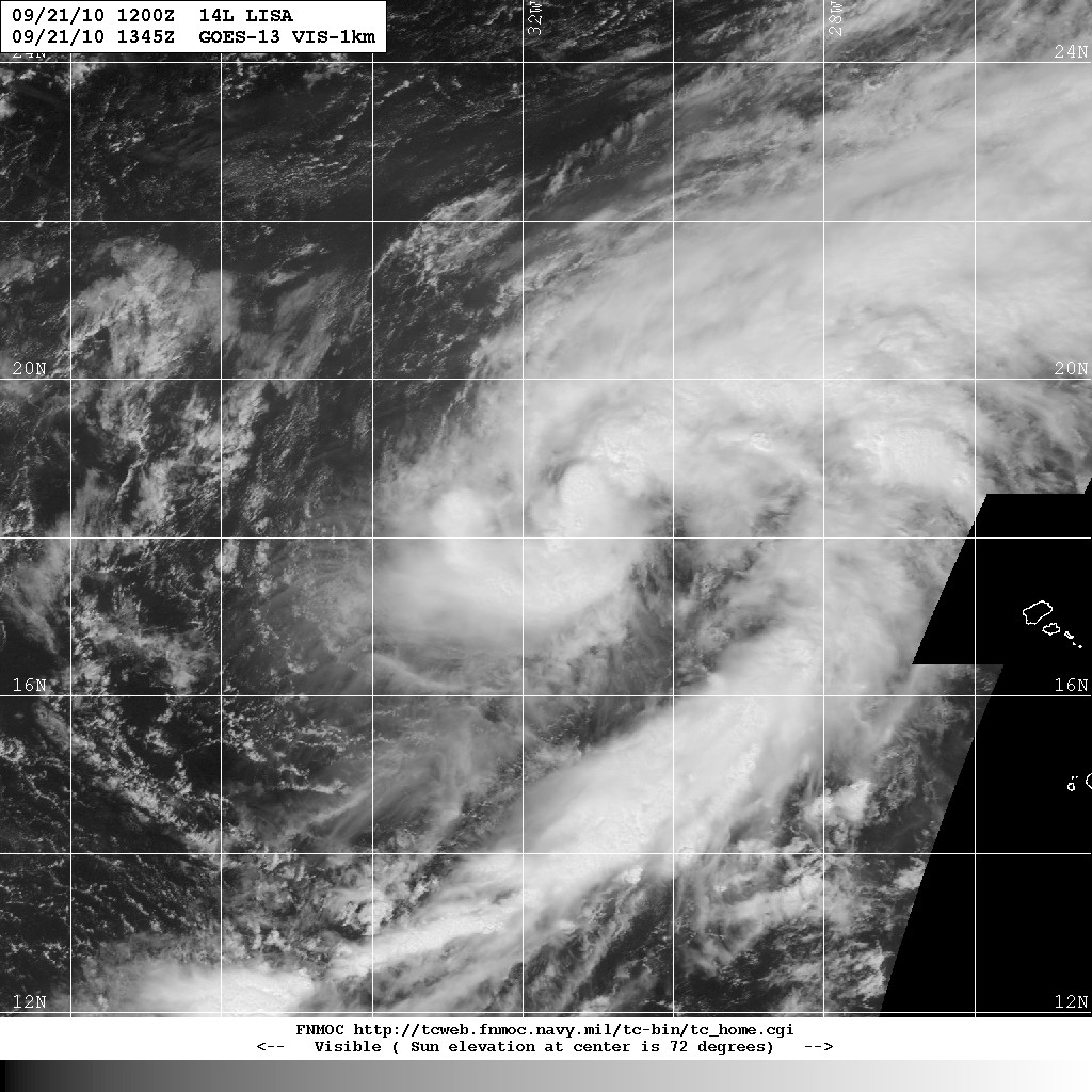
And just so the entertainment doesn't end, Tropical Storm Lisa has emerged in the tropical eastern Atlantic.


Click any image to enlarge.

Monday, September 20, 2010

Hurricane Igor 20/1500Z


Hurricane Igor gave Bermuda a serious pummeling yesterday evening with the centre passing just a little over 40 miles to the west of the island. Correspondents reported widespread power outages and several storm related injuries at the island's medical facilities. Bermuda is well used to hurricanes and the stringent building codes minimize the losses due to storms.

Igor has accelerated its forward motion and started a northeastward recurve. The deep convection associated with tropical cyclones has started to wane. Located about 900 miles (1450 km) Southwest of Cape Race, NFLD, Igor is now tracking in a North-Northeasterly direction at 21 knots (39 kmh/24 mph). It has max sustained winds of 65 knots or less (120 kmh/75 mph). As Igor transitions to an extra-tropical cyclone is now presents a threat to coastal Nova Scotia and Newfoundland.

High winds and heavy rains can be expected along the southeast coasts of both provinces with occasional intense squalls.

A Tropical Storm Watch has been issued for Newfoundland from Stones Cove northward and westward to Jones Harbour.

This should make iceberg alley a really interesting place to be.

Sunday, September 19, 2010

Hurricane Igor 19/1530Z


Hurricane Igor is within range of Bermuda with stations and correspondents reporting hurricane force winds already. In many places the power has been out for several hours. Igor is the only remaining hurricane in the Atlantic and remains a powerful cyclone.

At 1500Z (UTC/GMT) the centre of Igor was located 135 miles (220 km) South-Southwest of Bermuda tracking North at 14 knots (26 kmh/16 mph).

Igor's eyewall has collapsed and there is considerable weakening, however it remains a Category 1 Hurricane and is forecast to remain so for the next few days. Igor has max sustained winds of 75 knots (139 kmh/86 mph) with gusts to 95 knots.

Igor should start to make another turn after passing Bermuda. It will likely accelerate in a Northeasterly direction and will begin to transition to an extra-tropical cyclone. It will continue to remain a hurricane for some time and is forecast to be at Cat 1 strength as it passes Cape Race, Newfoundland.

Bermuda weather radar at 1520Z. Image BWS (Webcam!)

Click on any image to enlarge.

Saturday, September 18, 2010

Hurricane Igor and Tropical Storm Julia 18/1400Z


Hurricane Igor has weakened over the past 24 hours and is now placed at the top end of the Category 2 scale. Igor has estimated maximum sustained winds of 95 knots (175 kmh/110 mph) with higher gusts.
At 0900Z (UTC/GMT) the cyclone was located about 475 miles (765 km) South of Bermuda tracking Northwest at 11 knots (20 kmh/13 mph).
Igor will probably restrengthen to Category 3 over the next 24 hours and then gradually weaken, Igor is a massive cyclone and Bermuda lies directly in the forecast path. The official CPA of Igor's centre to Bermuda is 10 miles. Within the bounds of storm forecasting, that is a direct hit.

Hurricane Warnings are up for Bermuda. Bermudians can expect a long assault by Igor. Hurricane force winds extend out to 90 nautical miles (105 miles/165 km) in some quadrants. Tropical Storm force conditions can be expected by this evening Bermuda time and Hurricane force winds no later than Sunday evening but likely in the afternoon. It will then be a long haul for Bermuda as Igor passes and Bermudians should be prepared for 24 hours of Tropical Storm conditions, 8 hours (or more) of which will be Hurricane conditions.

Tropical Storm Julia weakened as expected and is now carrying sustained winds of 50 knots (93 kmh/58 mph). The cyclone is located 1525 miles (2450 km) West-Southwest of the Azores. It is tracking Northwest at 16 knots (30 kmh/18 mph). Julia is expected to weaken fairly rapidly due to high shear and much cooler sea surface temperatures in its path. This cyclone continues to constitute a risk to shipping although it poses no threat to populated areas.


A tropical wave located off the Cape Verde Islands has shown some significant development and is being closely watched. Invest 94L.
Friday, September 17, 2010

Hurricanes Igor and Julia 17/1400Z. Hurricane Watch for Bermuda


Hurricane Igor weakened slightly to become a "top of the scale" Category 3 cyclone. Depending upon what impresses you about natural meteorological/oceanographic phenomena, the size of Igor is amazing at about 1000 miles (1600 km) across its entire wind field.

Igor is about 730 miles (1175 km) South-Southeast of Bermuda tracking Northwest at about 8 knots (15 kmh/9 mph). It has maximum sustained winds of about 105 knots (195 kmh/121 mph). The present motion is expected to continue for the next 24 hours and then the cyclone should recurve to the North-Northwest. The forecast track from most models agree and Bermuda is likely to get anywhere from Tropical Storm force effects to those of a direct hit in about 2 to 3 days time. Igor's forecast track keeps it in warm water and a light shear environment so any significant weakening will not likely occur for a few days yet. There is a bit of dry air to the west of it, but the cyclone's size and strength will ward off that effect.

As Igor passed ocean buoy 41044 wave heights of 35.8 feet (11 meters) were recorded.

Bermuda is on Hurricane Watch with the centre of Igor approaching on Sunday morning. Correspondent in Bermuda states that the local marketplace was jammed with people stocking up supplies and that people were charging up electronic devices in preparation for power outages.

Hurricane Julia is behaving pretty much as forecast. It is slowly weakening due to the influence of wind shear. There will be greater influence on Julia from the outflow pattern of Igor which will cause further deterioration. Julia continues to present a risk to shipping with 75 knot (140 kmh/86 mph) winds. Position is about 1450 miles (2330 km) Southwest of the Azores tracking West-Northwest at about 21 knots (39 kmh/24 mph) although a traditional recurve is evident in its track. Julia is being steered by an upper level ridge. It should start tracking to the northeast as it passed around the western edge.
Julia poses no threat to population at this time.

Click any image to enlarge.

Thursday, September 16, 2010

Hurricanes Igor and Julia. Tropical Storm Karl. 16/1300Z

Hurricane Alley has a story this morning and it's Tropical Storm Karl. The cyclone emerged from the Yucatan virtually intact and about 30 miles (50 km) south of the original forecast. Karl moved over the Bay of Campeche to be met by less than 5 knots of wind shear and sea surface temperatures that in some spots are higher than 30 degrees C. All conditions are very favourable for rapid intensification and there is little doubt that Karl will grow very rapidly to become a hurricane over the next 12 - 36 hours.

Karl is currently located in the southeastern section of the Bay of Campeche tracking West-Northwest at about 8 knots (15 kmh/9 mph) with sustained winds showing an initial intensity of 55 knots (102 kmh/63 mph).

Hurricane Watches have been issued for the east coast of Mexico from La Cruz southward to Palma Sola. Karl is forecast to be near the Mexican coast as a hurricane late Thursday or early Friday. Hurricane Warnings will likely be issued for that same coast later today.

Hurricane Igor intensified over night with sustained winds of 125 knots (232 kmh/144 mph). It remains a Category 4 cyclone presently located about 440 miles (710 km) East-Northeast of the northern Leeward Islands and 955 miles (1535 km) South-Southeast of Bermuda. The hurricane is tracking West-Northwest at about 6 knots (11 kmh/7 mph).

Igor is in an area of low wind shear and high sea surface temperatures which support the cyclone remaining a very dangerous hurricane for the next few days. Igor is expected to recurve as it moves around the subtropical ridge. The threat to Bermuda is increasing.

Hurricane Julia is weakening as it feels the effect of divergence from Igor. Upper level wind shear is increasing and Julia is entering an area of cooler water. It should start to gradually weaken in the next 24 hours and thereafter experience a more rapid decay.

Julia is located about 875 miles (1410 km) West-Northwest of the Cape Verde Islands and assumed to be tracking northwest at about 16 knots (30 kmh/18 mph). Maximum sustained winds are estimated at 90 knots (167 kmh/104 mph) with decreasing intensity as it moves along its track.

Julia is a threat to shipping but currently poses no danger to populated land areas.

The satellite image below shows all three Atlantic cyclones: Karl to the left, Igor in the centre right and Julia off to the extreme right. (As always, click on any image to enlarge).

Wednesday, September 15, 2010

Hurricanes Igor and Julia. Tropical Storm Karl. 15/1500Z

Igor has weakened slightly this morning, Julia handed us all a surprise by strengthening to Category 4 and Karl has made landfall in the Yucatan.

Hurricane Igor is a massive Cat 4 cyclone with a wind field that stretches about 550 miles (885 km) across. Currently located about 540 miles (870 km) East-Northeast of the northern Leeward Islands and about 1050 miles (1700 km) Southeast of Bermuda, Igor is tracking West-Northwest at about 7 knots (13 kmh/8 mph). After pushing to the top of the Cat 4 scale last night there was some weakening overnight. The cloud tops have showed some warming and the inner eyewall has shown some deterioration. An outer eyewall has formed and while this normally weakens a cyclone, Igor is not expected to weaken much more over the next day or two. Sustained wind speeds are estimated at 115 knots (213 kmh/132 mph) with considerably higher gusts.

It is still too early to make landfall predictions although more and more it appears Bermuda could wear the brunt of Igor.

Hurricane Julia suddenly increased in intensity last night giving forecasters and some of the models a surprise. The cyclone moved quickly to a Cat 4 storm. Julia is currently located 595 miles (955 km) West-Northwest of the Cape Verde Islands tracking in a Northwesterly direction at about 13 knots (24 kmh/15 mph). It has sustained winds of 115 knots (213 kmh/132 mph). Although well developed, Julia is starting to the feel the effects of Igor's outflow winds and shear from an upper air low. It will soon start to encounter lower sea surface temperatures which will begin to cause weakening sometime in the next 24 - 48 hours.

This cyclone presents an extreme risk to shipping but currently presents no threat to population.

Tropical Storm Karl spawned rapidly and powerfully from a depression to a well organized tropical storm. Low wind shear and high sea surface temperatures fed this system and the forecast now suggests that Karl, having made its first landfall on the eastern Yucatan will eventually restrengthen over the Bay of Campeche to a Category 1 Hurricane before making a second landfall somewhere on the east coast of Mexico. Karl's landfall was just north of Belize at 1245Z (UTC/GMT) with estimated winds of 55 knots (102 kmh/63 mph). Because Karl is not a large system there is a possibility that its deterioration over the Yucatan will hamper its development once it moves out into the Bay of Campeche, however, the conditions are ripe to feed this system as it can once again move from a depression to a hurricane.


Click on images to enlarge.

Tuesday, September 14, 2010

Hurricane Igor and Hurricane Julia - 14/1400Z


The Atlantic just north of the Inter-Tropical Convergence Zone is a nasty place to be this morning. Two hurricanes are working their way westward across the tropical North Atlantic.

Hurricane Igor flirted with Category 5 yesterday as wind speeds reached 130 knots (241 kmh/150 mph). Initial wind speed has reduced to an estimated 115 knots (213 kmh/132 mph) although broad atmospheric conditions are well in line to support a restrengthening over the next two to three days. Central pressure is currently 945 mb.


Igor is located about 750 miles/1200 km east of the northern Leeward Islands tracking in a West-Northwest direction at about 7 knots (13 kmh/8 mph). The cyclone is expected to slowly recurve poleward and take a classic route around the subtropical ridge. It's still far too early to forecast any possible landfall, but most models are suggesting that Igor will spend most of its time at sea. The unknown factor is Julia. Now that it has increased to hurricane strength there is a greater chance that the two systems will begin to have an effect on each other. That could change Igor's forecast track significantly. Correspondent on Antigua is reporting large swells making an appearance.

Julia became a hurricane, the fifth of the Atlantic season, early today.


It is located 330 miles/535 km west of the Cape Verde Islands tracking West-Northwest at 10 knots (19 kmh/12 mph). Maximum sustained winds are estimated at 65 knots (120 kmh/75 mph). Julia will probably strengthen a little however, the sea surface temperatures along the forecast track become cooler for a short spell which should limit Julia's strength. The upper air divergence (outflow winds) from Igor will likely have the effect of increased wind shear on Julia which will also limit strengthening.


Note: The forecast track for Igor shows a direct hit on Bermuda. This should be viewed very carefully since it is the 5 day forecast track. The actual track could extend to either side of the cone or anywhere in between. And, the track forecast will likely change as the hurricane progresses.

As always, click on any image to enlarge.

Monday, September 13, 2010

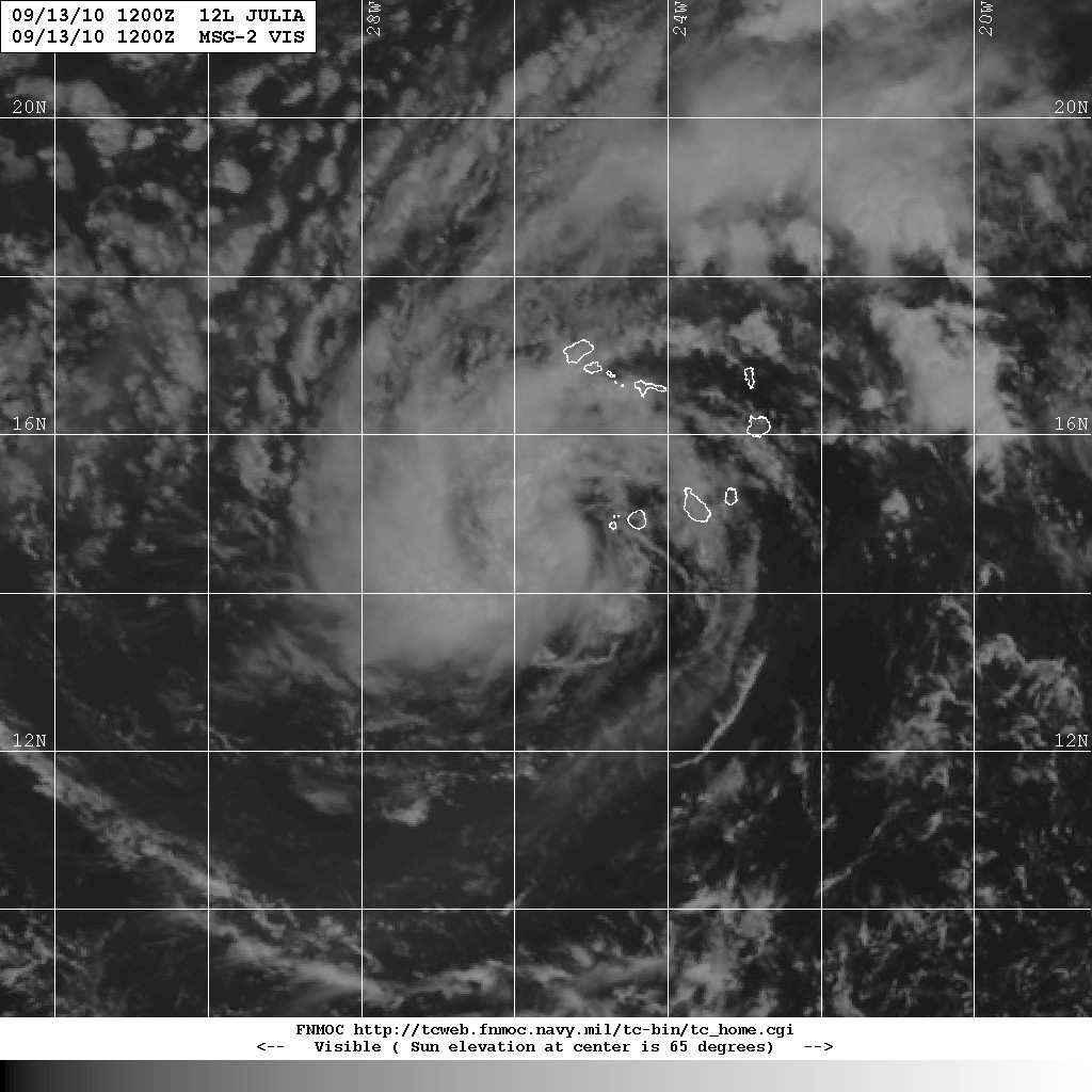
Hurricane Igor and Tropical Storm Julia

It took a while for Igor to develop in the tropical eastern Atlantic but now, with some extraordinarily high sea surface temperatures and minimal wind shear, this cyclone has reached the upper limit of Category 4 on the Saffir-Simpson Wind Scale and is now a major hurricane. Official NHC guidance is that Igor will not reach Category 5 although that depends on some changing upper air conditions. Most intensity forecasts show support a system that will strengthen today and then gradually weaken as it undergoes eyewall replacement. Some intensity models suggest Igor will indeed become a Cat 5 cyclone.

Igor is located about 940 miles/1500 miles east of the Leeward Islands of the Lesser Antilles tracking westward at 11 knots (20 kmh/13 mph). It packs sustained winds of 130 knots (241 kmh/150 mph). Most models are in agreement that Igor will start to slow its forward progress somewhat and start to adopt a track tendency north of west. That will see the cyclone move slightly poleward before it has a significant impact on the Lesser Antilles. It is far too early to forecast where Igor will become a major threat to population although at least three models suggest a probability of Igor making a pass over Bermuda as a major hurricane.

Tropical Storm Julia is located about 85 miles WSW of the Cape Verde Islands. Initially a bit difficult to pin down, Julia is tracking West-Northwest at about 11 knots (20 kmh/13 mph). Sustained wind speeds are estimated at around 35 knots (65 kmh/40 mph). Julia is not expected to intensify over the next two days, however there is some significant divergence in the forecast models. The current prognosis is that Julia will move further to the north and intensify by mid-week.

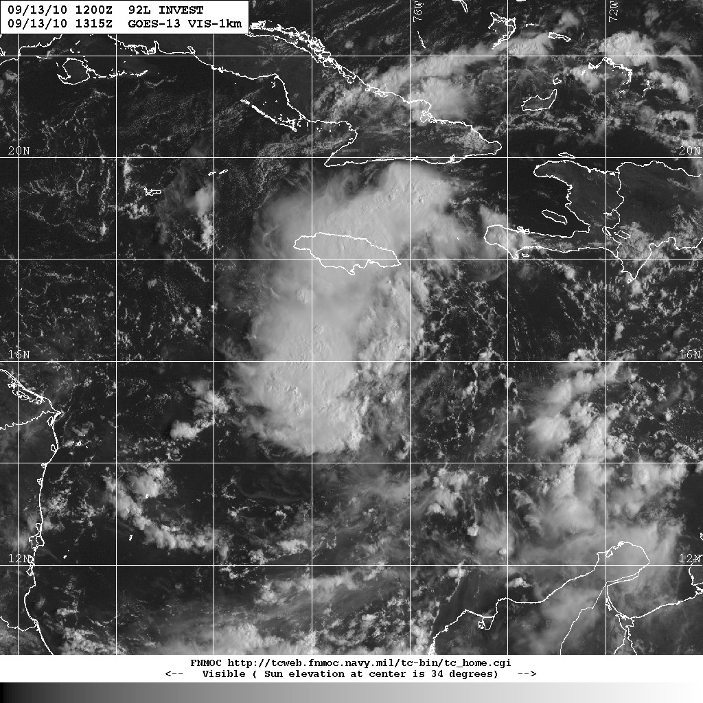
We're also watching this somewhat disorganized cloud formation created by a trough of low pressure over the central Caribbean, designated 92L.