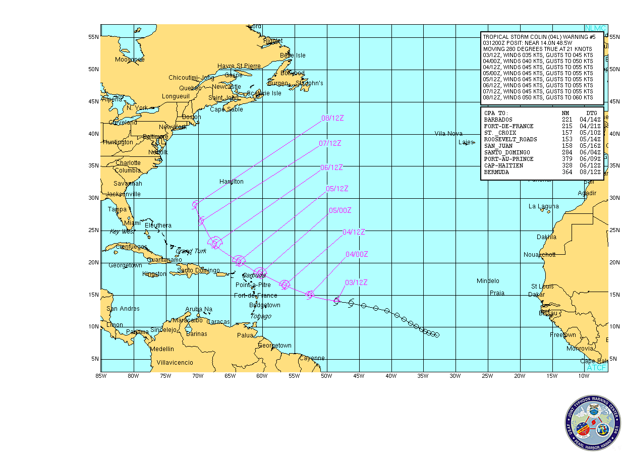
Tropical Storm Colin had almost died. Then it found conditions which allowed it to restrengthen and now we have a fairly powerful cyclone bearing down on Bermuda with a likelihood of arriving there early Saturday morning.
Colin is what we might call a "classic" cyclone. Its track is typically moving around the Bermuda high.
 Earlier there was enough wind shear to clear away the thunderstorm activity from the centre giving a clear satellite view of the rotation, however that seems to have diminished and the cloud activity appears to have moved westward.
The conditions ahead of the forecast track to the north will give Colin an opportunity to intensify. Two models forecast Colin becoming a hurricane within 72 hours while others are providing lower sustained wind speeds. The official NHC forecast is a peak intensity of 60 knots.
The cyclone should go extra-tropical (move northwards out of the tropical storm area) in about 72 hours at which time it will encounter the Westerlies which should begin to sap it of the conditions to maintain its energy.
The track guidance is in good agreement so this cyclone should pass through Bermuda and leave most of the US Eastern Seaboard and Nova Scotia alone. At least for now. That forecast is fairly long so the system should be watched.
Invest 93L

Another one to watch is Invest 93L, a system approximately 675 miles west of the Cape Verde Islands. At present this is a poorly organized system, however conditions favour some development. A close watch on this one.
(Click on any image to enlarge)